At 2:00 AM on June 21, 2020, my two friends and I began climbing Mt. Shasta; what followed was an exhausting 2 day trek filled with many highs, lows, and a helicopter rescue. Whether you’re reading this just for kicks or preparing for a Shasta climb of your own, this post should offer some interesting content.
If you’re just looking for cool video, skip to the Helicopter rescue section
Table of Contents
- The Mountain
- The Plan
- The Gear
- The Ascent
- The Descent
- The Helicopter Rescue
- Getting off the mountain
The Mountain
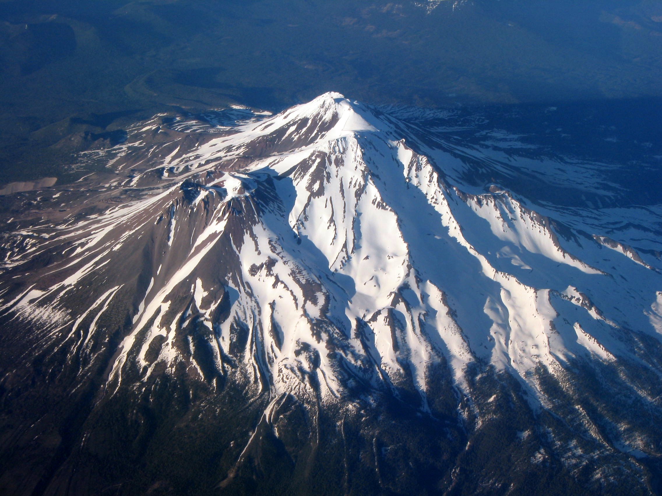
If you’re not familiar with Mt. Shasta, the mountain is a 14,179’ potentially active stratovolcano in Northern California near Redding. It’s mostly known for its prominence - rising nearly 10,000 ft from the surrounding central valley, and visible from over 140 miles away on a good day - it’s by far the most striking and commanding peak in California and possibly the lower 48.
In the winter, ascending Shasta is limited mostly to professional mountaineers and dedicated enthusiats. Freezing 100mph+ winds, massive snow drifts, and dangerous glacial conditions make ascents for laypeople particularly dangerous. The late summer brings both annoyance and danger; melted snow makes previously easy snow/ice routes untenable due to rock fall danger and daunting scree fields. John Muir famously found himself stuck on top of Shasta in summer, somehow assailed by both freezing winds and “unendurable heat”.
The best time to climb Mt. Shasta is during late spring and early summer. This is when there is still enough snow for easy snow/ice ascents but reduced danger from avalanches and frigid winter conditions. It is also a great time to enter the Lemurian portal and meet the ancient civilization living under the volcano ;)
The Plan
Climbing Shasta is usually a two-day affair for non-athletes and non-mountaineers; most people take two days to hike the Avalanche Gulch (AG for short) route, which runs from Horse Camp (7.8k feet) to the summit, camping along the way at Helen Lake (10.4k). Although the name Avalanche Gulch inspires fear of a certain kind, it is actually the easiest route on the entire mountain… that is, if you don’t mind the summer crowds.
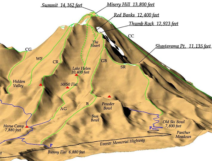 It looks tame in this rendering, but most of the slopes are steep enough to require ice crampons and ice axes.
We took a local’s recommendation and instead chose to ascend the West Face (WF), a longer but much less crowded alternative. The plan was to have two full days on the mountain after making the ~1 hr trek to Horse Camp from the Bunny Flat parking lot.
We originally planned to just hike the mountain. But, with our ski season cut short from the COVID-19 fiasco, we decided to YOLO it and ski the damn thing. This was both the worst and best decision ever. Hauling a hundred pounds of gear up 7,000 vertical feet really sucks, but skiing makes the descent a thousand times more rewarding. We settled on the final plan the night before:
Day 0: Haul our gear to base camp at Horse Camp, and stay the night.
Day 1: Haul our camping gear up to a high camp on West Face at around 11,000 feet, dump it, and make an attempt on the summit.
Day 2: Summit again, or just ski laps on the fun parts of the mountain! Then, hike out back to Bunny Flat.
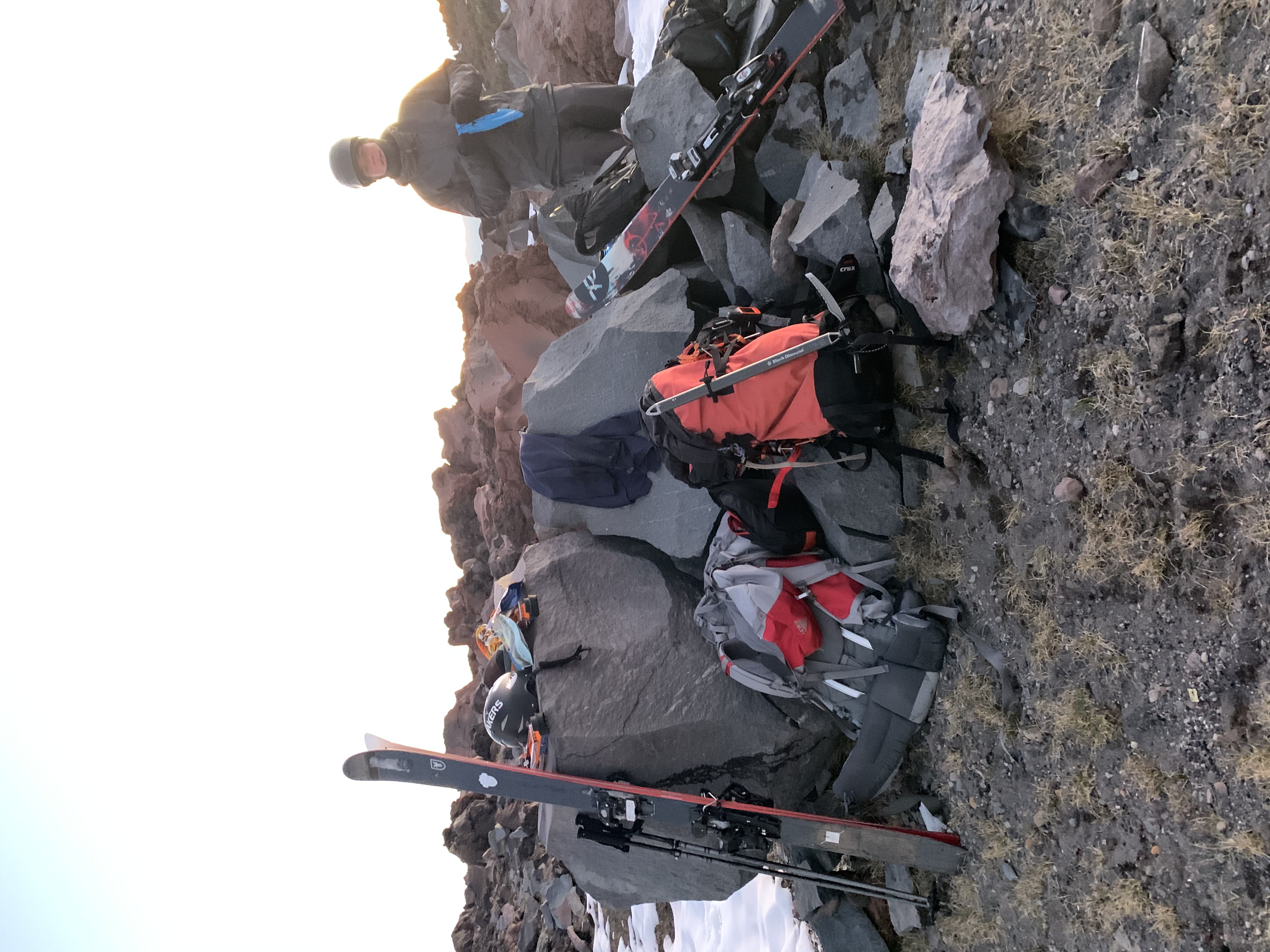
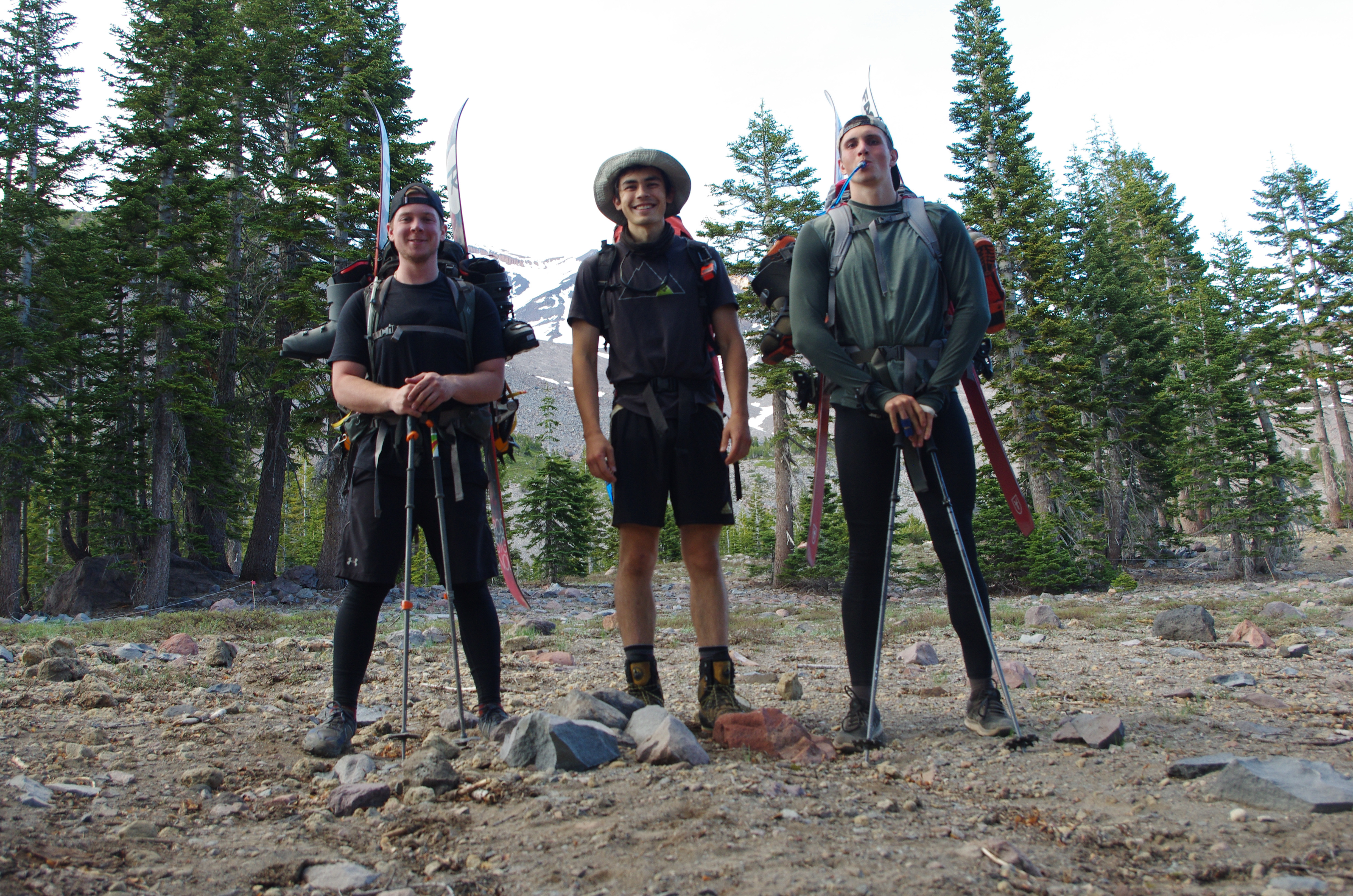
The Gear
Here’s a list of my ramshackle gear I managed to scrape together to make the ascent.
Skiing
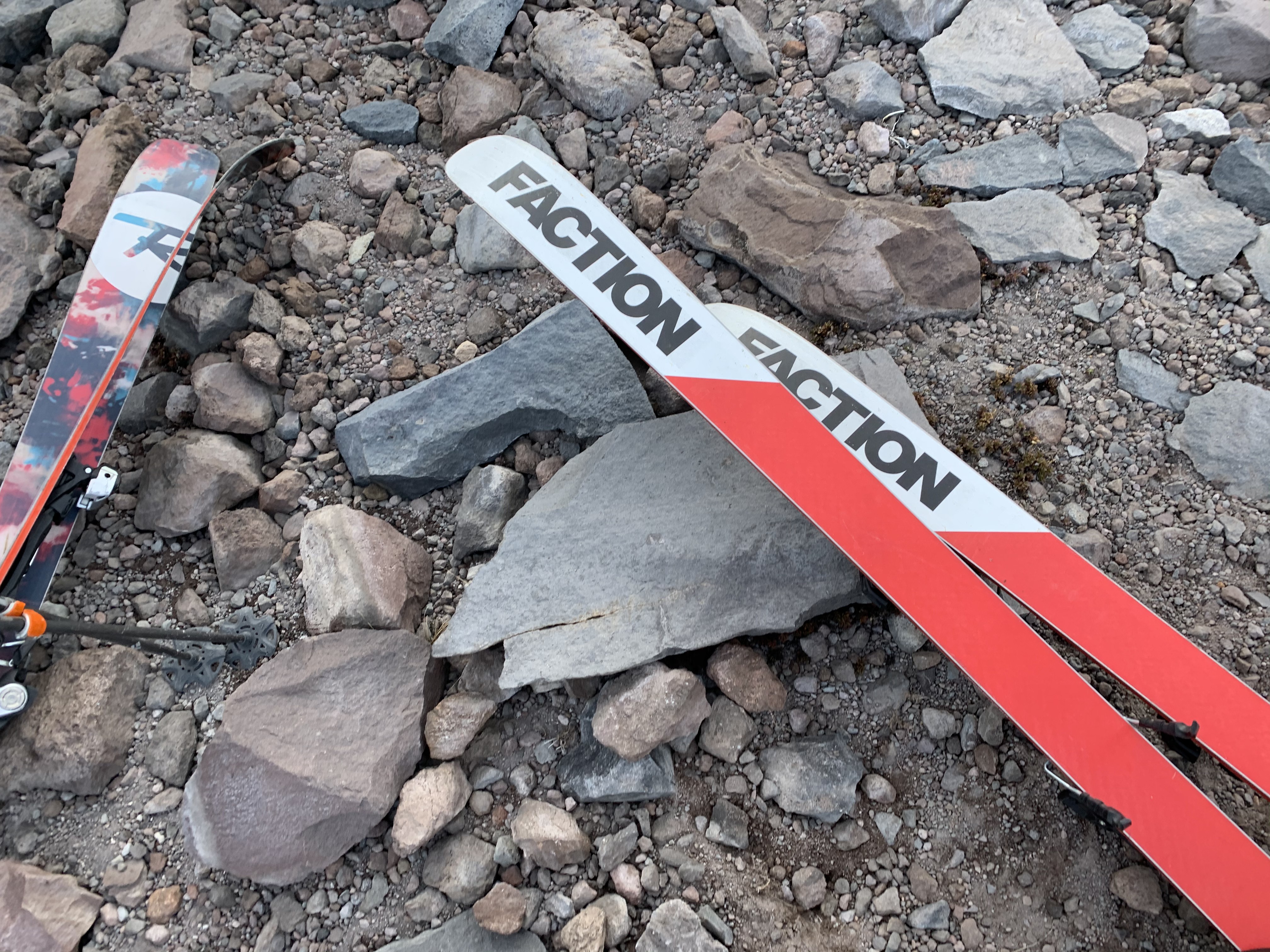
- Faction prime 2.0 SE 184cm skis with Tyrolia Attack 13 demo bindings: Some beater skis and random bindings I picked up at a ski swap. We didn’t have a chance to wax or tune the skis before we left, so they were not ready for the snow. The bindings had to be finaggled somewhat to fit my boots since they were so heavily used. In short, NOT THE OPTIMAL SETUP FOR A BACKCOUNTRY EXCURSION.
- Daymaker touring conversion bindings: These turn traditional downhill bindings into tech (hiking) bindings. Upside: cheaper than a full AT backcountry setup; Downside: heavy.
- Black diamond Ascension climbing skins
- Armada collapsible poles: mostly meant for resort riding, but hey, they work!
- Ski boots: Matching the theme here, these are my resort boots, meaning they’re nice on the way down and hell on the way up.
- Helmet
Mountaineering
- Black diamond crampons
- Black diamond ice axe: Necessary for ascending and descending on ice. If you need to self arrest during an uncontrolled slide, you’d better have it on you.
- 25m paracord
Camping
- Lightweight sleeping bag
- Lightweight sleeping pad: Important if you’re sleeping on snow
- Ultralight tent
- Camping stove: needed if you want clean water.
- Freeze-dried food: and snacks!
- Human waste bags: Yes, you have to haul it out with you. Yes, it is actually as bad as it sounds.
- Camelback with 3L bladder: Nicer for hiking if you don’t need to take much with you, i.e., for a day hike ascent.
- 80L camping backpack
Clothes
- Ski jacket shell
- Ski pants with bib (overalls)
- Nylon low-friction ski socks
- Ski gloves
- Thermal upper layer
- Dry-fit upper layer
- Dry-fit long underwear
- Beanie: good for sleeping, because it is cold at night
- Hat: nice for hiking :)
- Sunglasses: Absolutely necessary unless you want to go snow blind. Goggles are nice for the way down, but will fog while hiking.
- Nike running shoes: They had some life left in ‘em
Assorted
- Multitool
- Sawyer straw
- Sunscreen
- Chapstick
- First aid kit
All in all, the two skiers each had around 90-100lbs of gear.
Ascent
Hard alpine hikes are best done with what’s known as an alpine start, which meant we woke up at the crack of 2:00 AM in Horse Camp and were on the trail well before 3:00 AM.
The first few miles were on a loose rocky singletrail. The night before we left, the nice volunteer steward at Horse Camp gave us some advice on how to find the right couloir. I remember it more like a witch’s prophecy:
Over three ridges you will go, rife with rock and dust and wind. Cross one stream, but not two; there you will climb the mountains twin.
 The “mountains twin” referring to Shasta and it’s conjoined sister, Mt. Shastina. Image from usgs.gov
And for the first three hours, over the three ridges we did go. The streams right beyond the third ridge were the first snow we encountered (Hidden Valley, 9,000ft), and the narrow ridges the WF runs up opened into the huge valley of WF.
 Looks smaller in the picture; in person, it’s HUGE! And look at that shadow.
From the bottom of this valley, you can see all the way up to the false peak of WF at 13,500ft. It’s awe-inspiring and motivating at first… less so six hours on when you still haven’t reached it.
As you can see, we were still hiking in shoes to this point, which made scurrying up ice a bit precarious. The slope continued to get steeper until we needed to put on the crampons and break out the ice axes.
 7:30am, 10,000 ft. We dumped most of our camp gear here and considered using this bluff as high camp.
After putting on crampons WF progresses into more “mountaineering” terrain. Steeper.
 The circled area is probably the steepest on the entire WF route. We measured it at more than 50 degrees (if you’re familiar with ski terms, this means borderline unski-ably steep). The only way to get up it is on all fours (or with a rope), leading with the ice axe and supported by crampons. It is not good if you slide down; the rock bluff 200 yards below sits right at the outlet. This area becomes important later on…
By 9:00am we had made it above the steepest section, but the snow had started to soften up and the altitude was starting to get to us. It was too steep to skin up, so we resolved to zig-zag cramponing, a technique meant to “even out” the fatigue on your legs across the leg muscles. Every ski-booted step with skis on our back was getting tougher.
The next 3,000ft were exhausting due to the altitude. The false peak, only a mile and 700 vertical feet from the summit, taunted us for the next 5 hours. The ice melted into slush, our boots sunk up to our mid-thigh when we hiked. Better equipped, more seasoned mountaineers glissaded and skied down, giving us words of encouragement on our way up.
At 1:00pm we reached the false summit at 13,500ft. We could finally see the top!
I unfortunately don’t have many pictures from this part. But here’s the scene: our two skiers, wheezing with exhaustion, laying on the ground. Our friend, an ultra-marathoner with no extra ski pack weight, laughing at us. And one inexperienced group of four on their way down, the leader of which I remember saying:
I haven’t glissaded much before… but since the snow is soft, this should be fine, right?
We dumped as much ski gear as we could and continued onward, our motivations renewed from seeing the summit.
We eventually came upon a couple who were hopelessly lost just below Misery Hill, the final few hundred feet below the summit. At this late point in the day it was already 2:00pm; we had already been hiking for 12 continous hours. It took us another 45 minutes to orient these poor souls back down towards Avalanche Gulch. But finally, we were only a half mile and a few hundred vertical feet from the top!
Misery Hill has it’s name for a reason. The sun-facing aspect was covered in patchy rocks and snow, making climbing it in crampons unwieldy. For those unlucky (or ill-prepared) enough to not be acclimated to the altitude, your limbs feel like they’re made of iron and your lungs full of cotton. It’s hell.
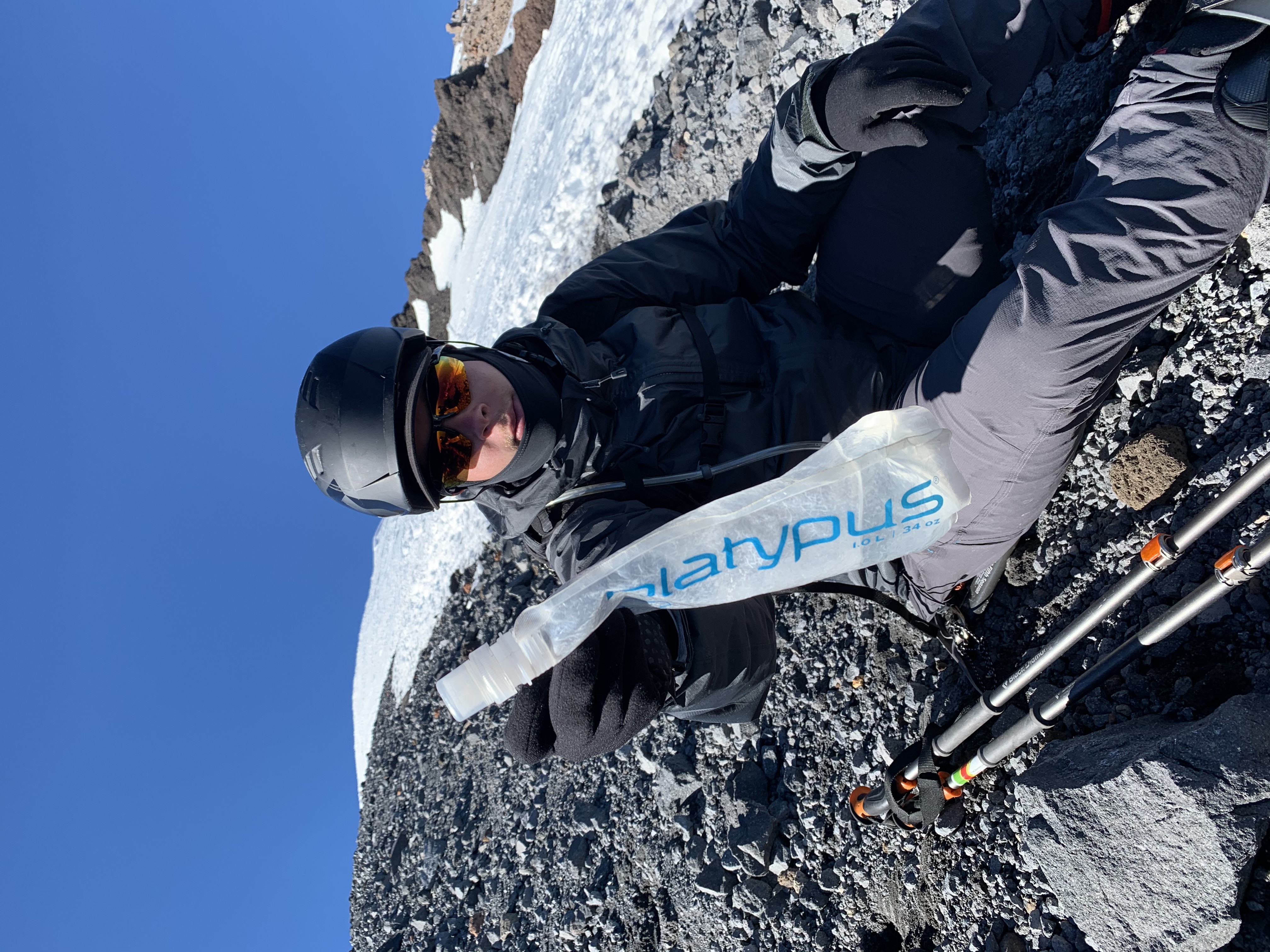 That’s the true summit, in the background. Thanks for the platypus, Michael.
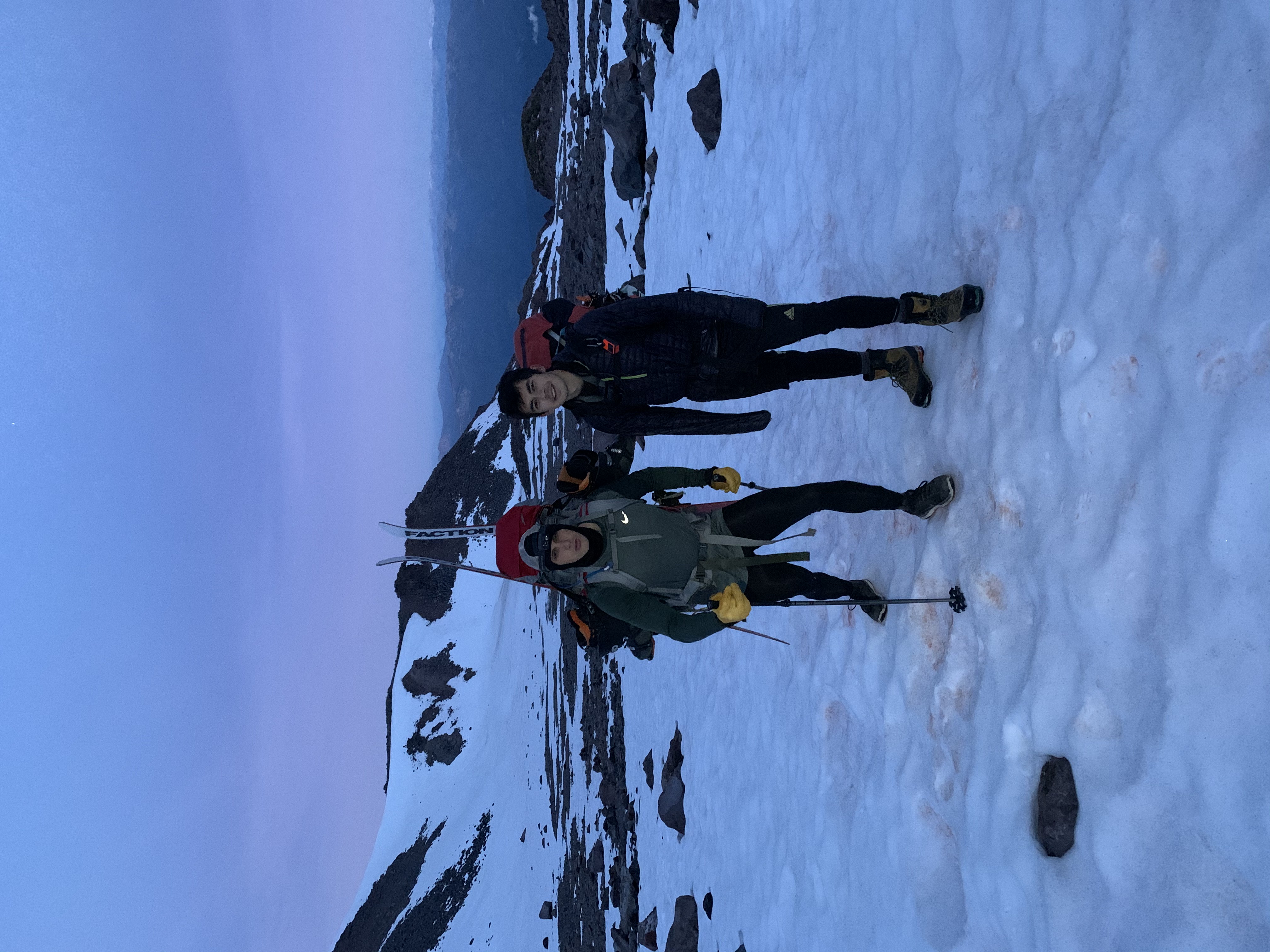
At this point the skiers were so exhausted we could not make the true summit, though it was tantalizingly close. We were beyond Misery Hill. Only a couple hundred feet from the true summit (as the crow flies). But we were totally, utterly drained. I was dry heaving and could barely move. At 4:00pm, we risked hiking down at dark, exhausted and disoriented and freezing, with slush turning to sheet ice in the next few hours at summit temperatures. So our choices were either summit and risk having to be rescued like idiots … or turn around.
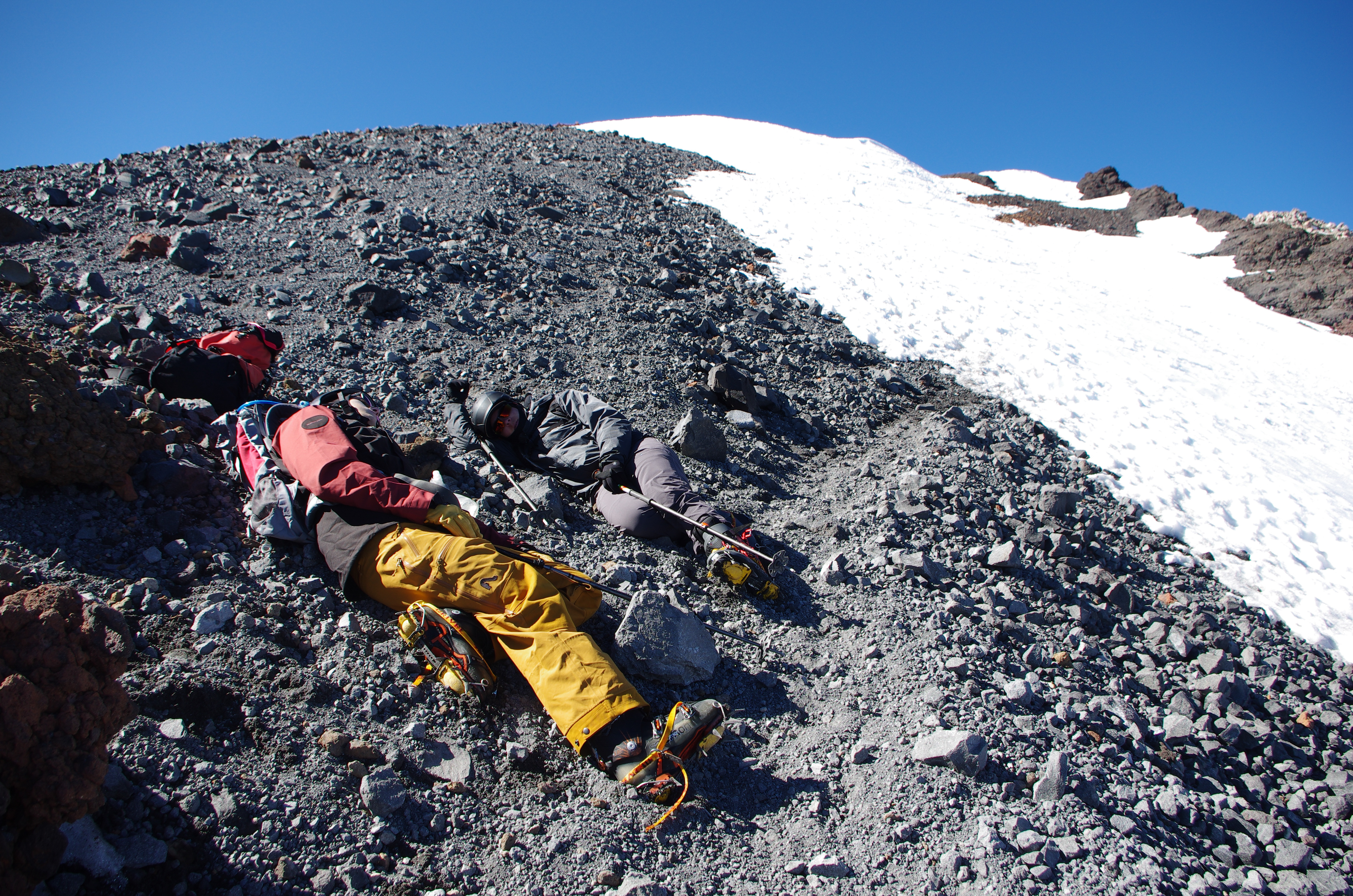 We’re not looking so hot.
Descent
Hiking down was not much easier than hiking up. Coming down Misery Hill is also hell. But eventually we got back to the false peak with our ski gear, and that’s where the fun begins:
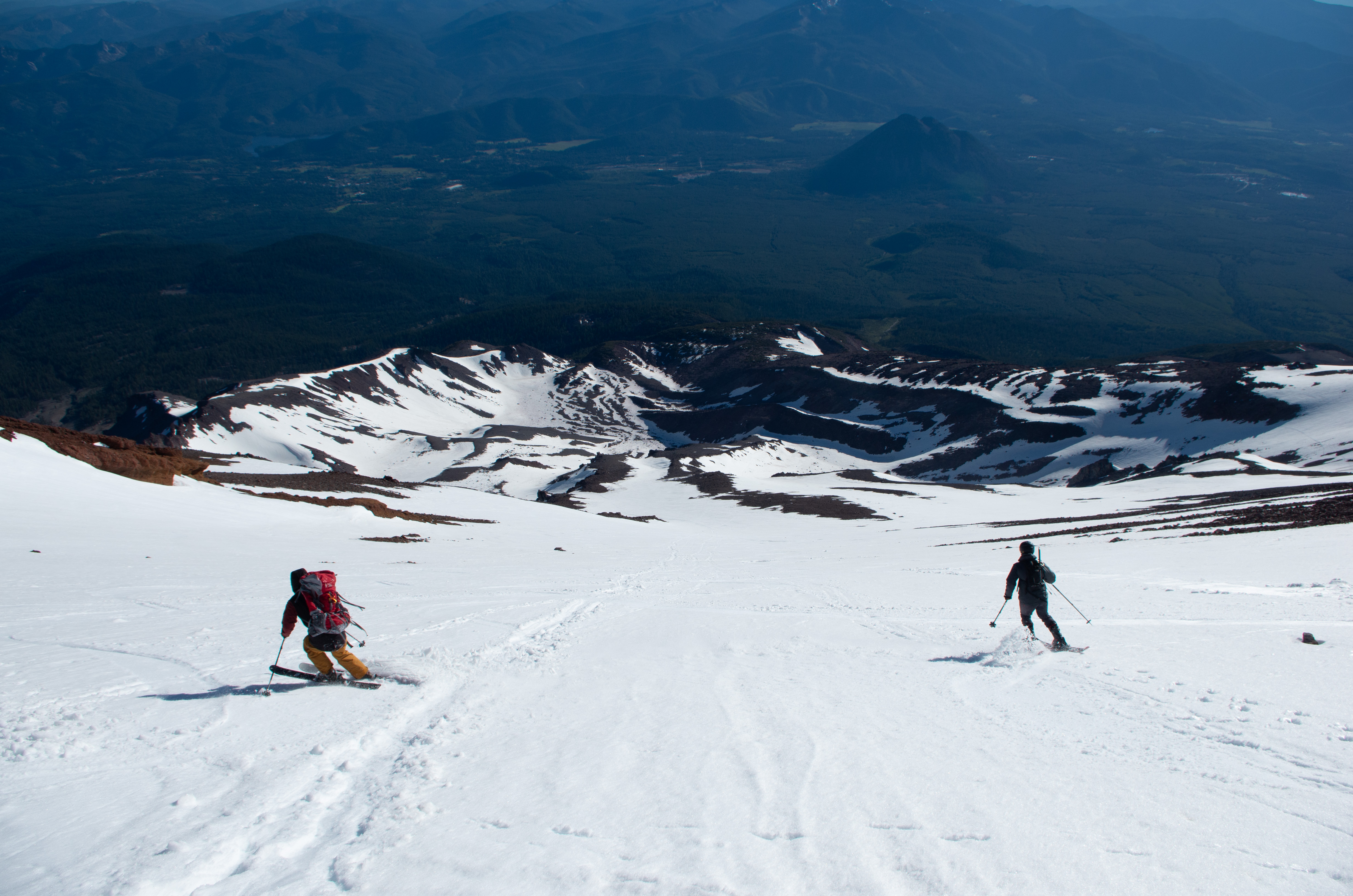 Photos courtesy of Sean Anderson.
Surprisingly, while I could barely stand upright hiking, skiing came quite easily.
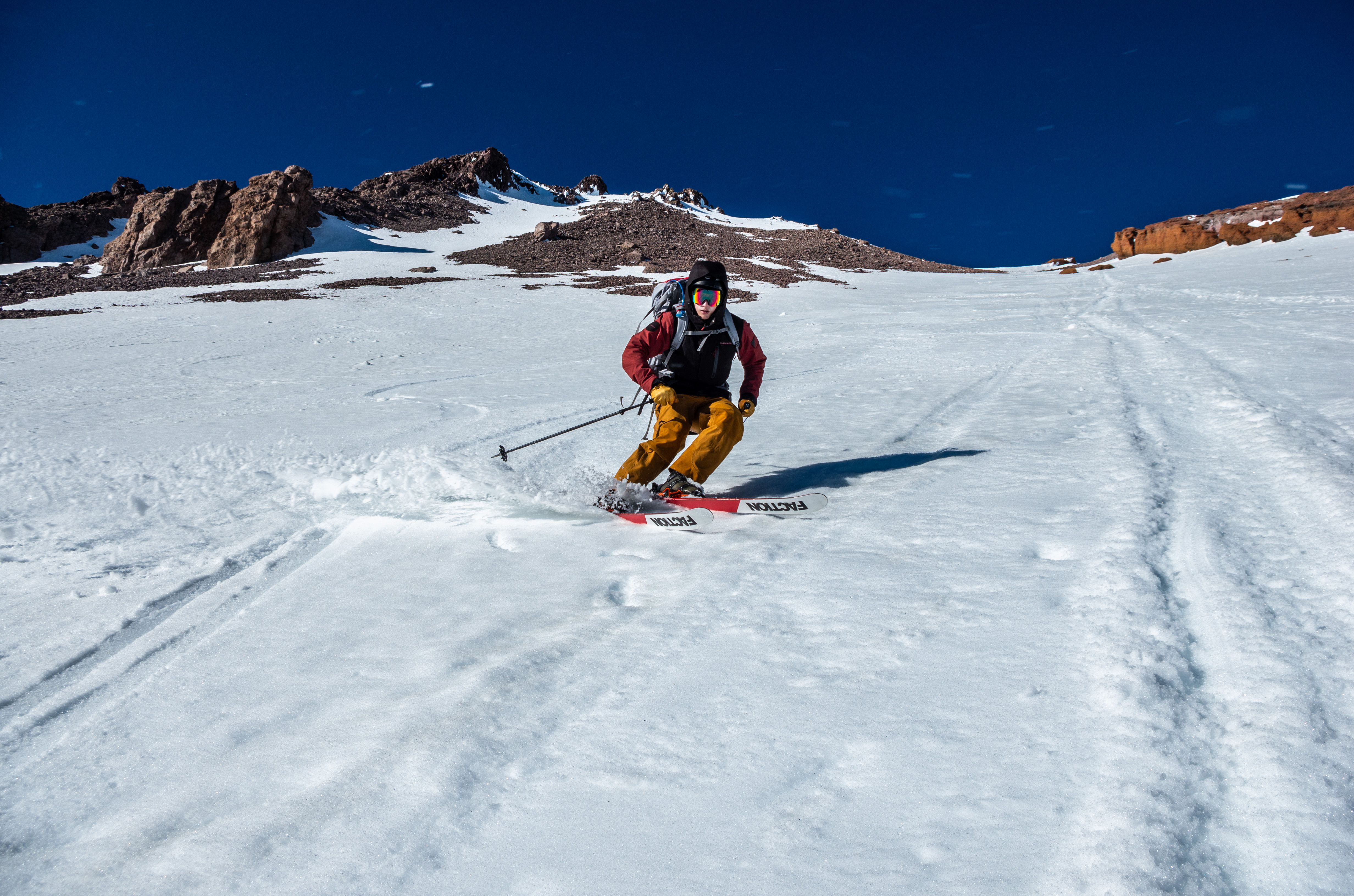 Even on skis without a wax, with bindings barely holding my boots to the planks, altitude sick, dry heaving. Still shreddin the gnar. If anyone from Faction is looking to give out a sponsorship, you know how to get ahold of me ;)
After 10 minutes in heaven, we made it down to the steepest slope - so steep as to be barely skiable - leading down to our high camp. We would never risk it if it was icy. But since the snow was still soft (5:30pm), we were confident we could do it. As the skiers were about to come down though…
Remember that group from earlier?
Helicopter rescue
That’s right. The glissading party from four hours ago had tried to slide down the ridge without knowing this route (they had taken a different route up, we later discovered). The leader had lost control of his descent and slammed into the rock spire. We came down right as the heli-rescue was arriving, but since the helicopter’s view was blocked from the ridge, the crew couldn’t see the injured party.
Atop the ridge, we were in perfect position to direct the helicopter. I’ll let the pictures and videos tell the story.
 The helicopter spots Sean, on the flat of the ridge above the steep
 Sean directs the crew
 The rescue crew descends; they’re a bit out of view in this picture
 The helicopter was only 50 horizontal yards from us: at the same altitude! The heli was a hundred feet above the injured party and the injured party was a hundred feet below us.
The helicopter dropped off a one-woman rescue crew with Sean. With no hesitation - and confidence like I had never seen before - this heroine glissaded down the steep from an angle I would have thought impossible without ropes. This is what separates the professionals from the amateurs.
Apparently the injured guy had broken his lower leg and needed to be airlifted immediately.
And they flew off into the sunset.
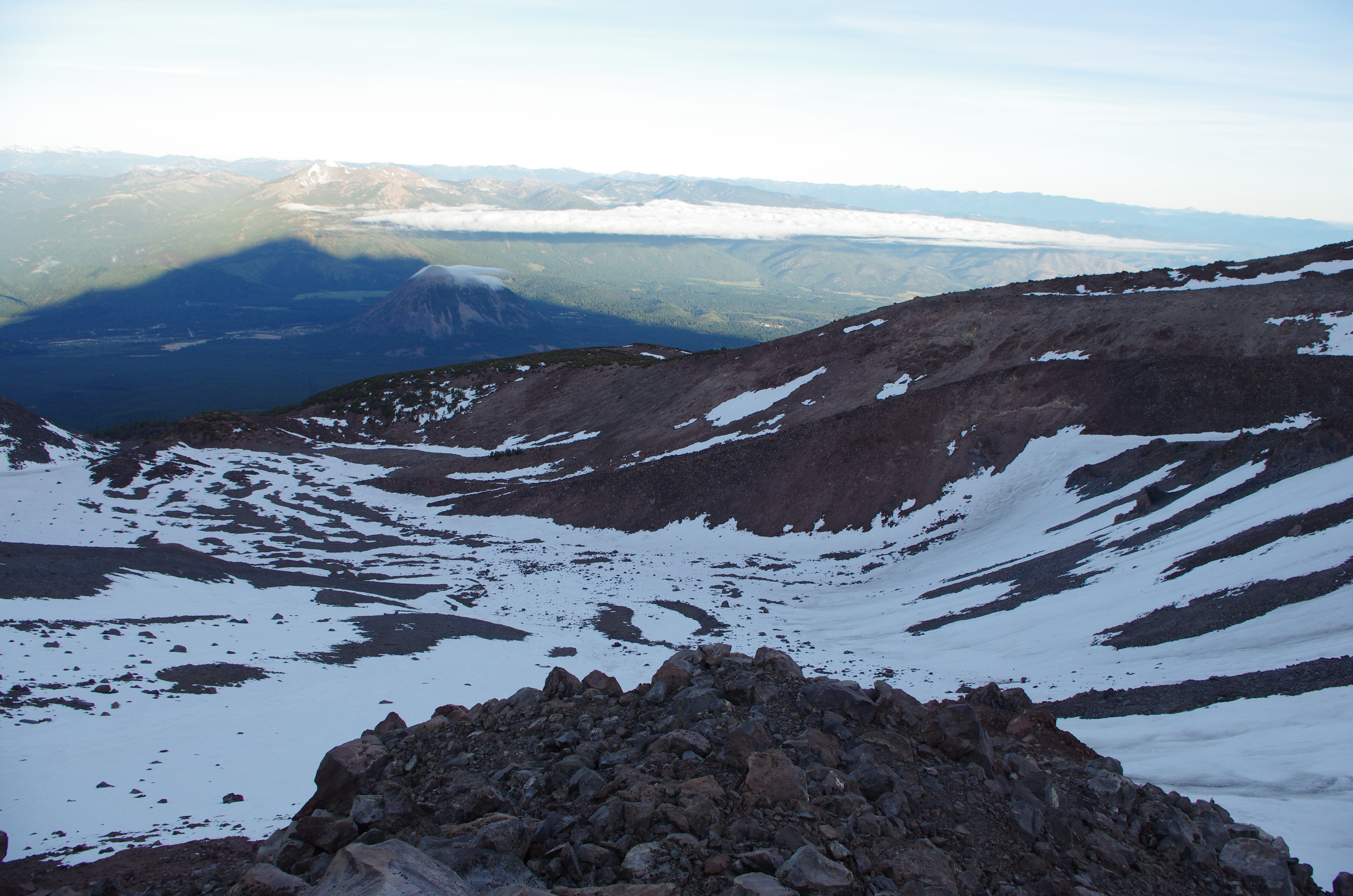
Getting off the mountain
After checking in with the injured party and rescue crew, we skied and glissaded down to our high camp. The helicopter, oddly enough, left the one-woman-wonder rescuer to hike out by herself.
 Ski tracks. Neither pictures nor words do this behemoth mountain justice. It really is so much more massive than you can imagine.
 Alpenglow?
 A panoramic view
Surprisingly, we managed to ski down to the absolute edge of the snowline, at about 9,000ft in Hidden Valley. It was quite an interesting epilogue to our heli-rescue experience, between dodging rocks, sliding around in extremely wet snow (remember, this is lower down on the mountain where sun-facing aspects have been baking all day), and riding watermelon snow. We made our final camp on the edge of Hidden Valley at 7:00pm or so. We slept well.
Unsurpisingly, we didn’t attempt to summit on the following day but instead hiked down to Bunny Flat.